The Infrastructure Long Play
Johnny Sanphillippo is a Strong Towns member who blogs at Granola Shotgun. This post is republished from his blog with permission.
Image via Wikimedia Commons
I’m going to draw a line from Colonial America to the near future in order to get a broad picture of infrastructure and land use patterns. For the last couple of centuries, it’s been déjà vu all over again.
This is Emanuel Leutze’s highly stylized 1850 oil painting of George Washington and the Continental Army crossing the Delaware River on Christmas 1776. It’s part of America’s mythology about our War of Independence from the British and our birth as a republic. Aside from the ever-so-slightly embellished patriotic imagery, the scene reveals some obvious realities of Colonial America. If you wanted to travel between New Jersey and Pennsylvania back then, you needed a boat.
Rivers were the original interstate highway system. All early colonial settlements were built on navigable waterways. Bulk commodities such as grain, coal, iron ore, timber, and gravel are still transported most efficiently and affordably on our inland rivers and inter-coastal seaways today. But rivers have some inherent flaws. In winter they freeze. In spring they flood. In summer they’re too low to traverse. Rivers have treacherous rocky falls and sandy shoals. And there’s the problem of having to load and unload wagons on either side of the water.
As a young man, George Washington led expeditions into the wilderness frontier of present day Maryland, Virginia, Pennsylvania, and West Virginia. Along the way he purchased great tracts of cheap land that effectively had no value since the territory was largely inaccessible. Later in life, he helped found the Potomac Company that gathered private capital and political support for the construction of river improvements linking the Chesapeake Bay to the nascent settlement in Cumberland, Maryland, 134 miles inland. Cumberland was the gateway to the Northwest Territory of Ohio and ultimately the Great Lakes. Those structural upgrades to the upper Potomac increased the value of land along the route. Infrastructure projects have always been first and foremost about property development.
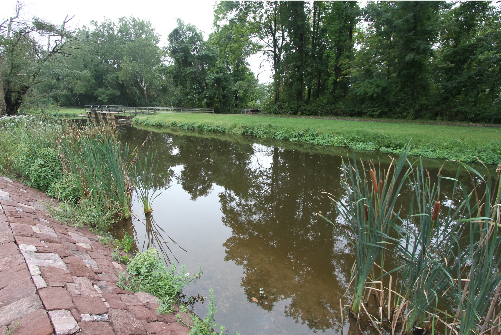
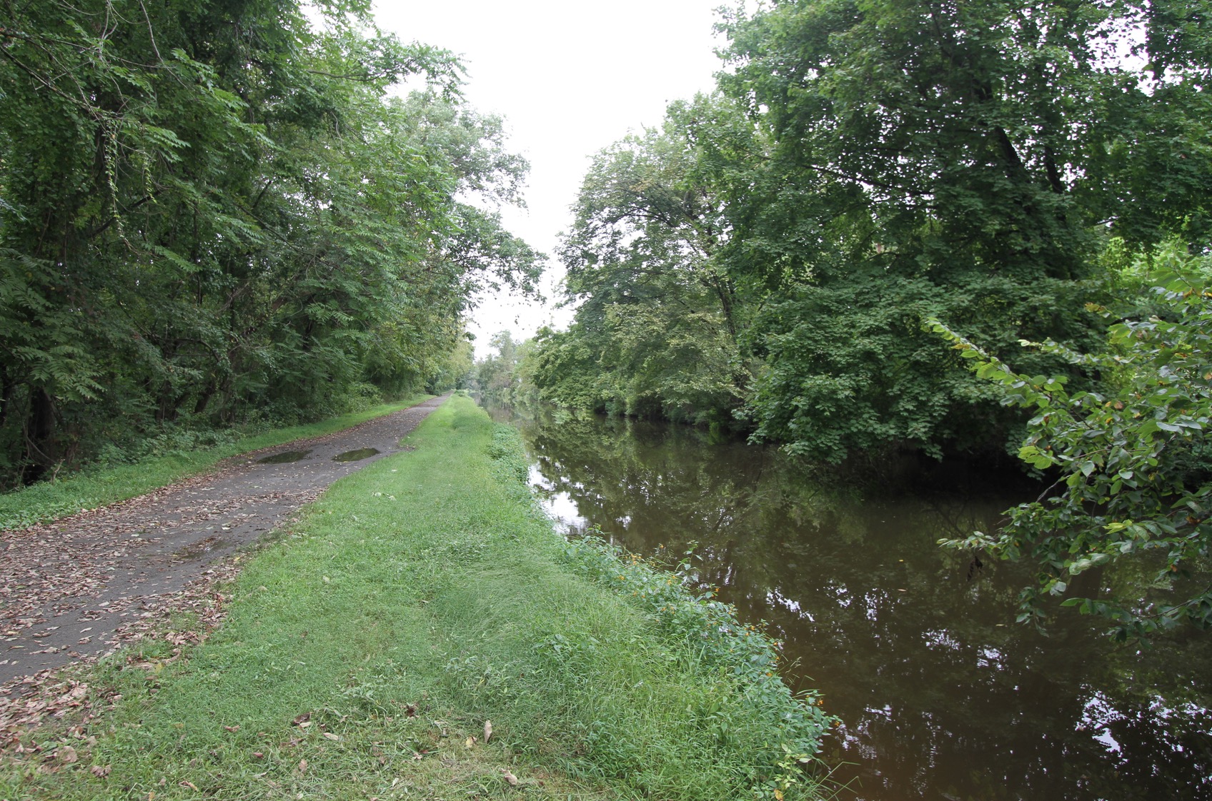
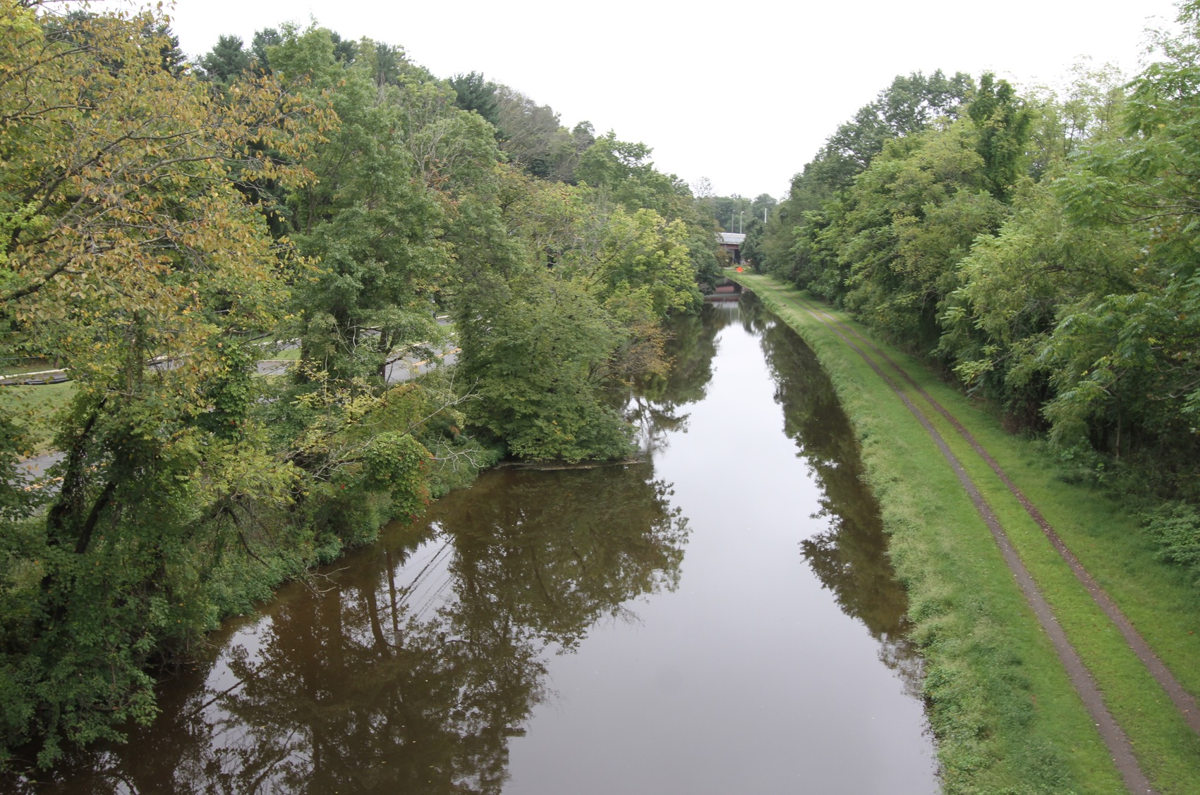
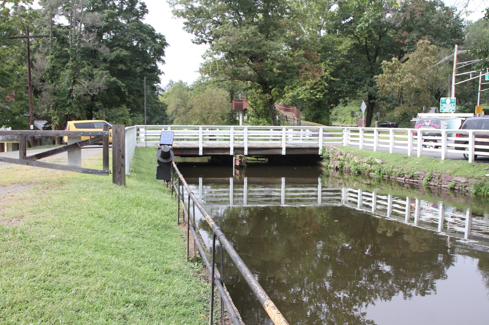
No less than William Penn himself dreamed of a Dutch style inland canal across New Jersey between Philadelphia and New York City back in the 1690s. That vision eventually materialized with the Delaware and Raritan Canal, but not until 1834. The canal radically increased the speed of transportation and greatly reduced the cost of hauling freight, benefiting both ends and everything in between. Up to 20 tons of cargo could be loaded on a canal barge. The weight was supported by the water and pulled by a single mule along the toe path. Canals were a hay and oats-powered transportation network. The canals were hand dug by an inexhaustible supply of Irishmen recently arrived in America. The mules were more expensive and had better working conditions.
Today the canal is a forgotten relic, a vestige of a previous era. Portions of it are gone, buried to make way for modern development. Other stretches are preserved as linear parks for tourists. But most of it quietly degrades for lack of interest.
New England had long established mill towns fueled by waterfalls. Canals like this one in Springfield, Massachusetts knitted together industry and commerce all along the Connecticut River Valley from the Canadian border to Long Island Sound.
But canal traffic declined rapidly once coal powered steam railroads ramped up in earnest. Rail had the advantage of being able to cross long distances of completely dry land, climb mountains, maintain year-round service regardless of weather, and dramatically increase delivery speed.
Traffic and revenue along the canals dried up just as the aging infrastructure needed costly maintenance. Watermills were replaced by more productive coal-fired factories that no longer needed to be located next to rivers. Whole new tracts of land along railroads gained value, while property along the canals stagnated and declined. The canal network suffered a slow death by attrition and neglect. Many mill towns have still not recovered economically. The American canal era lasted for seventy years.
This tunnel in Vernon, Connecticut is really more of a railroad bridge built to allow street traffic to flow below. It was built in 1849—also by large numbers of Irishmen. Railroads stretched out rapidly in every conceivable direction in the 19th century, opening up new sources of raw materials and new markets for manufactured goods. The more rail service increased, the more accessible, productive, and valuable adjacent land became.
A “rails-to-trails” recreational path on a former rail line in Vernon, CT
But today, like the canal system, just a few select rail lines remain in service. Only those that earn their keep through profitable commerce survive. The trouble with rail began with its relentless expansion. Too many speculative and unprofitable lines were built. Then the monopolistic rail companies squeezed customers a bit too hard and created political enemies. The cost of maintaining aging rail lines coincided with sharply declining revenue, punitive taxes, and increased regulations by popular demand. Most freight rail routes have been dismantled or converted to alternative uses today, such as recreational bike paths and linear parks. Like the canal era, the grand age of rail lasted for about seventy years before it sputtered.
But the end of rail transport really occurred for the usual reason. It was outperformed by a new kind of infrastructure that was faster, more effective, and allowed more dispersed mobility: the oil-powered Interstate Highway. People, money, commerce, and political will hit the open road. The Interstate and all the associated county and municipal roads expanded exponentially from 1956 until the present. Each new road opened up new territory to development and productivity in a virtuous upward economic spiral decade after decade. There was always a new cornfield, patch of woods, or remote desert to colonize out there on the edge of civilization. And America loved all of it.
Back at Washington Crossing in New Jersey is a bridge over the Delaware that’s now part of Interstate 295. It’s a highway that ties together the entire eastern seaboard from Florida to Maine, just as the historic inter-coastal waterways always have. The new bridge is being paid for almost exclusively by the federal government with (theoretical) money from the national gas tax. That fund has been in negative territory for two decades as expenses greatly exceed income.
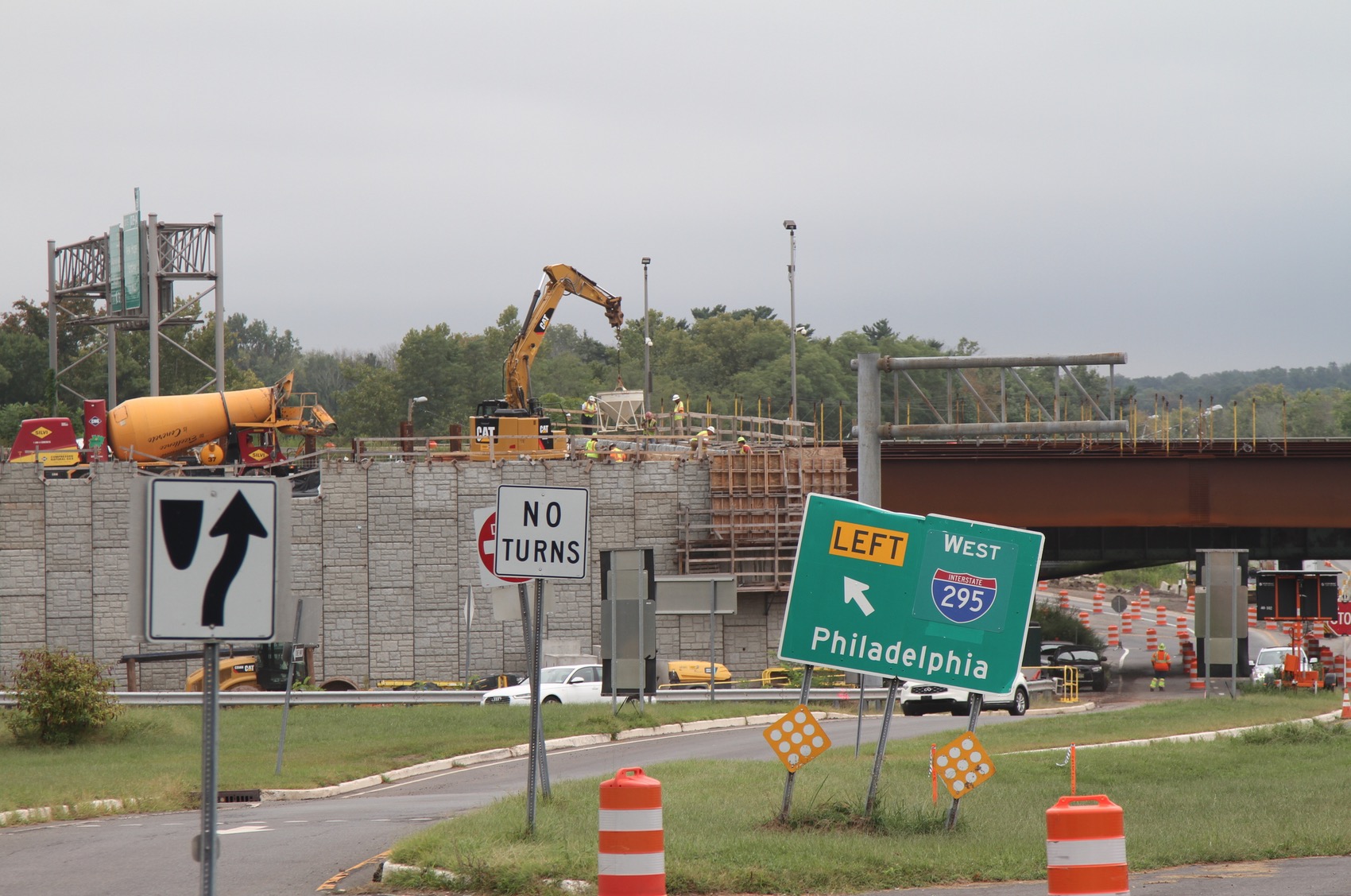
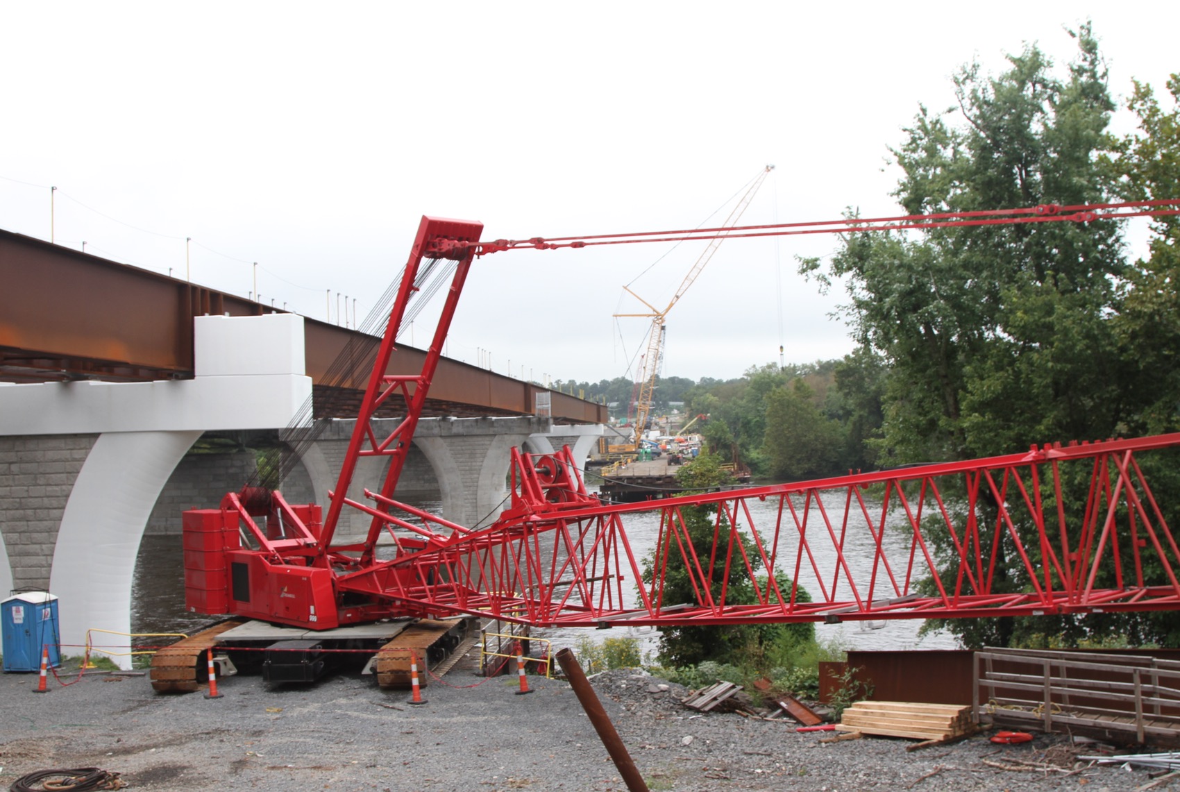
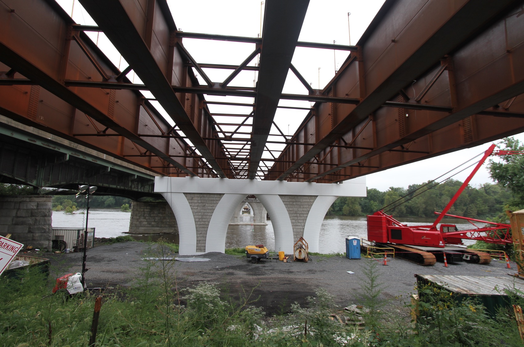
Meanwhile, New Jersey’s state gas tax has been rising to compensate for less than expected gas consumption and ever rising road maintenance costs on an aging network. Tolls and fees are rising. The new bridge and highway exactly duplicate the route of the old canal and a defunct rail line. We’re approaching the seventy year mark of the Highway Era. The cost of maintaining the entire system is beginning to outstrip the benefits. Sooner or later, triage will set in as people search for alternatives. Our collective willingness to keep each rarely used stretch of road paved will evaporate in due course. Only the truly productive bits will survive the fullness of time.