What's Wrong With This Picture?
If you spend much time out in nature, you know how to recognize the subtle and unsubtle signs of an ecosystem in distress. It could be a forest that’s eerily silent where you should hear birds and insects. It could look like an invasive species run amok: leaping Asian carp in the lower Mississippi River, kudzu devouring the Southeast or blackberry brambles overtaking woods in Oregon. When I visit the North Shore of Lake Superior in Minnesota, a favorite childhood destination, what hits me are the ubiquitous stands of dead and dying birch trees where I remember lush summer greenery. (The story there is complicated: the birches themselves were a non-native arrival a century ago, supplanting pine forests that had been clear-cut.)
All of these things tell a story: Something is out of balance here. Something is not right with this picture.
I do a lot of thinking about the built environment of our cities and towns as a sort of ecosystem in its own right. Our human economy is a complex adaptive system. And like an ecosystem, the whole thing exhibits emergent order, even though individual cause-and-effect chains are dizzyingly complex. It's why we can observe phenomena such as supply and demand dynamics on a large scale, much as an ecologist might look at how predator and prey populations fluctuate. Build too much retail space, for example, and you'll watch rents fall and vacancies rise. Patterns observable in the world give us clues as to the health of the overall system as it tends toward some sort of stable equilibrium.
Here’s the question, though: do we know how to recognize the signs of disruption in our urban habitat, the way we can spot them in a natural one? Or are we so accustomed to living in deeply unnatural, disrupted environments that we take them for granted, the way you might have played as a child in a stream that in your grandparents' day was teeming with salmon, without ever becoming aware of the salmon's absence?
Take, for example, the surroundings we see around train stations in some of America's largest and wealthiest cities—and, by and large, don't blink an eye at.
A Twitter user who goes by @dataandpolitics shared a collection of photos taken at Caltrain commuter rail stations in the affluent southern suburbs of San Francisco. They made the striking observation that at station after station, the immediately adjacent land uses are remarkably low-value. Parking lots. Vacant lots. Strip malls, auto body shops, a range of boxy, mundane, single-story buildings. In some of America's wealthiest ZIP codes, there is a stunning lack of wealth, development, or much of, well, anything interesting at all, visible from most of the stations. Here are some of the photos (reproduced with permission; the original tweet thread has been auto-deleted with age):
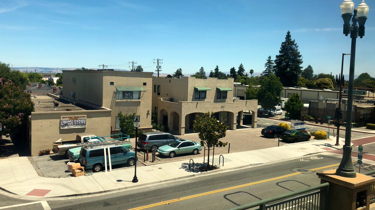
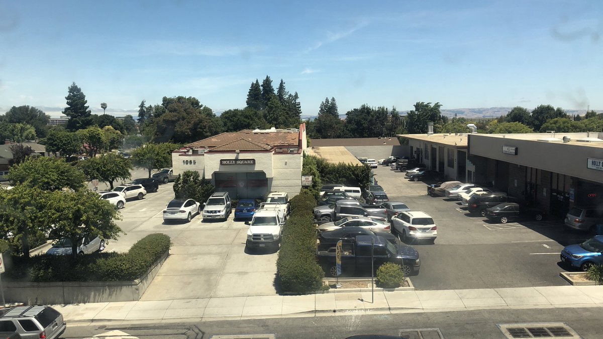
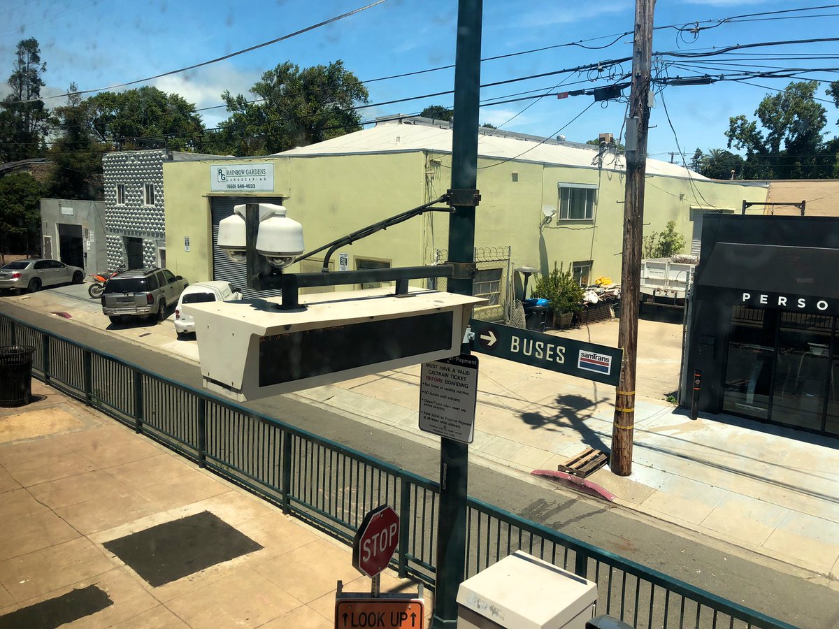
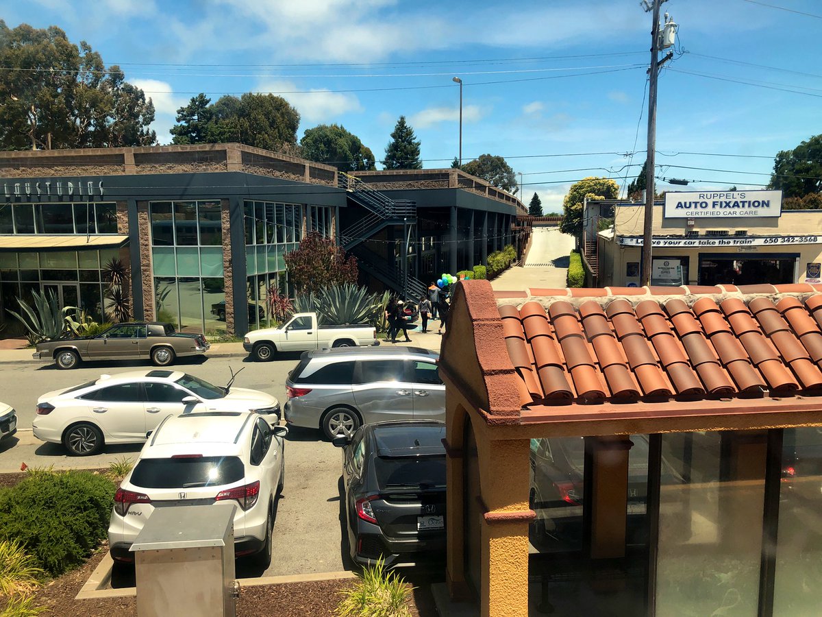
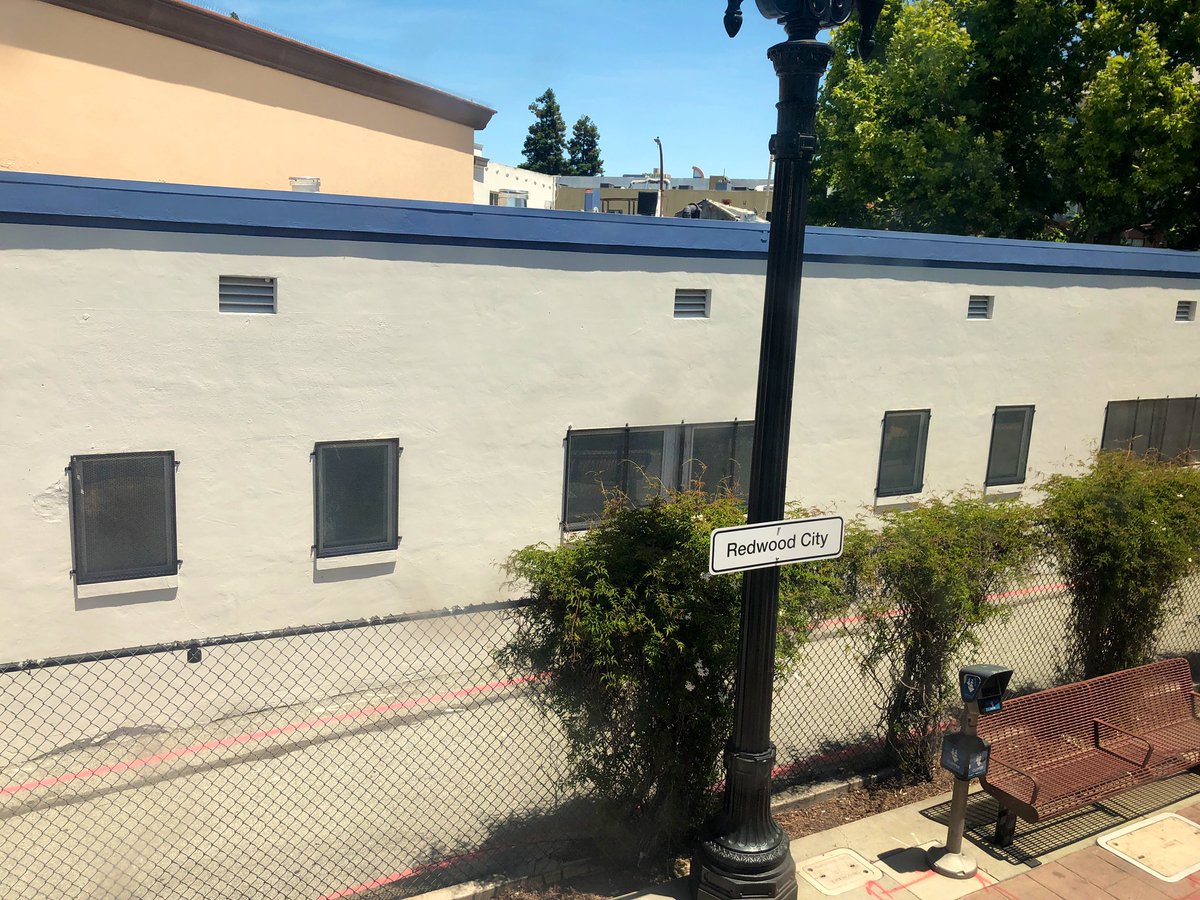
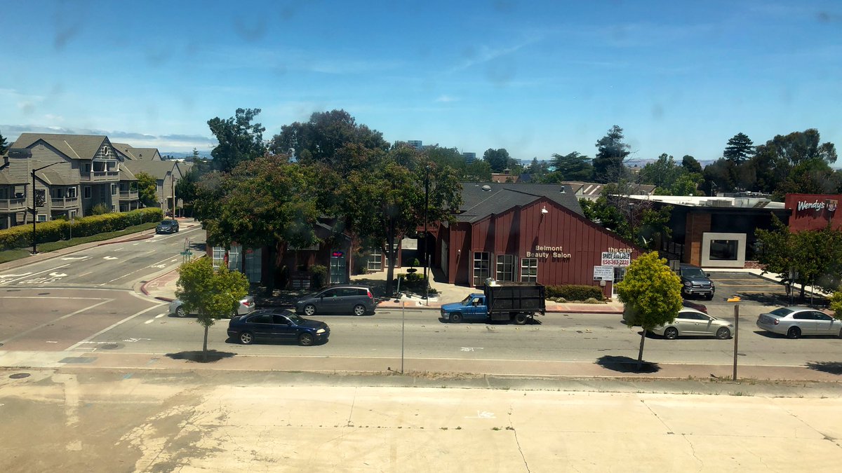
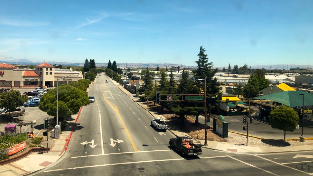
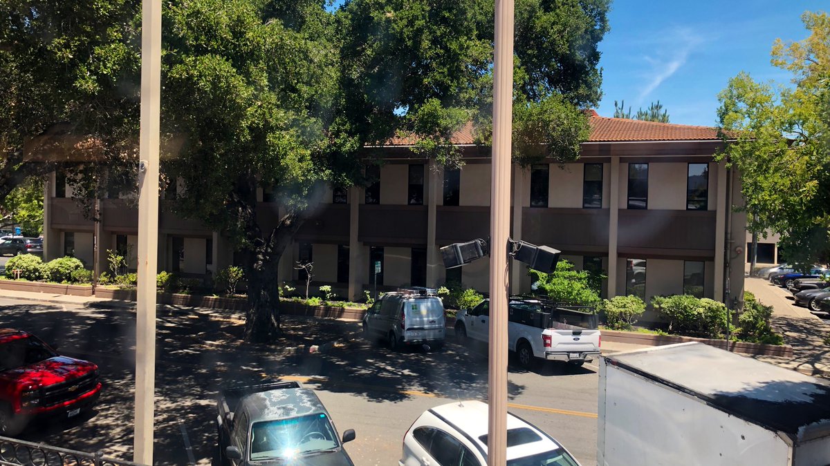
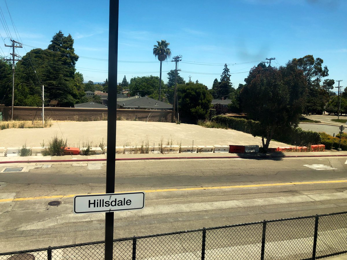
This is not a phenomenon unique to Caltrain, by the way: you can see a similar thing at a startling proportion of New Jersey Transit stations, for example. It’s common in North America—but not in much of the rest of the world, as we’ll see below.
Here's the thing: in a former chapter of my life I rode the Caltrain every day. I was a budding urban planning geek at the time, and am now a trained planner. And yet despite that, I had never really thought about the strangeness of this. It just was, in the same way that Walmarts with a parking lot twice the size of the store just are to many Americans; neighborhoods of hundreds of identical homes with identical 3-car garages just are; freeway interchanges fully the size of Renaissance Florence just are.
When you stop and think about it, it makes zero sense. This should be some of the most valuable land in the entire Bay Area (and by extension, the world), with some of the most lucrative development potential. On an always-crowded train with me every morning were employees of Facebook, Google, Apple, Oracle, Intel, you name it, who would disembark en masse at stations like water spilling out of floodgates. In the other direction, just as many commuters head for San Francisco's financial district, one of the most extraordinary clusters of wealth and innovation and high-paying jobs in the Western Hemisphere.
“Do we know how to recognize the signs of disruption in our urban habitat, the way we can spot them in a natural one? Or are we so accustomed to living in deeply unnatural environments that we take them for granted?”
The San Francisco peninsula is the ideal environment for commuter rail. Here, even the wealthy use public transit in large numbers, and that's been true for decades. The Peninsula's rail-friendly geography—a linear string of suburbs 50 miles long but never more than about 5 miles wide, hemmed in by bay and mountains—ensures you're never too far from a train station. Most of these suburbs have a historic, walkable main street or downtown district not far from the station, too, like a string of pearls on the necklace that is the Caltrain line.
So wouldn't you kill to have your business right at one of these stations enjoying its steady stream of foot traffic? Or your apartment right nearby where you can head out your door and hop on the train? These are spectacularly convenient, desirable locations; they should be the most developed places in their respective cities, and we should see the intensity of land use gradually drop off to low-rise offices and single-family homes as we move away from them. We’re far more likely to see just that in other countries with rail: commuter rail stations in suburban France, Spain, the Netherlands, Japan, and so forth are hubs of concentrated, walkable development. So why do so many of the Caltrain stations look like if you waved a magic wand and made the rails and boarding platform vanish, you’d never know they had been there?
I want to emphasize one point: this isn’t about subjective preference for one development pattern. I’m not saying, “We should have dense, walkable development around train stations because I happen to like dense, walkable development.” This is an observation about urban land economics. We should expect dense development around train stations because the land around train stations ought to be some of the most valuable land there is, and that should lead to denser development than elsewhere. When it doesn’t, we ought to look at it like an ecologist looks at a forest where there should be birds singing, and instead there’s silence.
This situation is rooted in distortions imposed on this economic environment by government policy. I’ll point out not an exhaustive list, but likely the two biggest ones.
Distortion #1: Zoning
The Bay Area went all in on the suburban experiment in the post-WWII half century, and nearly regulated traditional urban land uses out of existence. They did it through restrictions on building heights and densities, parking minimums, and in some cases the demolition of the previous urban fabric in favor of large-scale shopping centers and parking lots. The legacy downtowns may have been grandfathered in, but you couldn't go and rebuild taller even in those districts.
Downtown Menlo Park, for example, still looks like the below photo today. An attractive strip of one-story buildings, but still one-story—it looks like a quaint little town. Menlo Park is the hometown of Facebook, one of the most powerful corporations in the world, and has a median household income of $133,000 and median home value of over $2 million. Oh, and this area is walkable from the Caltrain station:
Low-rise, low-density zoning does a lot to explain Menlo Park. It can't explain all of these sites, though. Many of these cities have re-evaluated their suburban-style codes in recent years, developed transit-oriented redevelopment plans, allowed greater height and density, mixed uses, and less space devoted to car parking. Downtown Redwood City, for example, has a maximum height of 100 feet, a flexible mix of uses, and, while it has not outright eliminated parking minimums, allows developers to skip providing parking and pay an in-lieu fee if "providing the required parking spaces on-site is detrimental to the pedestrian nature of Downtown" or "encouraging users of the project site to walk from off-site parking to the project site would be beneficial to the Downtown."
Yet these single-story buildings are all within a 2 minute walk of Caltrain in downtown Redwood City:
At the same time, not 500 feet from them is a mammoth, brand spanking new mixed-use project at 889 Winslow, seen here under construction:
The visual contrast is stark. So is a comparison of the property values. The one-story retail building is worth $603,000; the brand new office building is worth $67 million. They are a block away from each other, on the same street, both adjacent to a Caltrain station with express service to San Francisco.
Zoning alone can’t explain that juxtaposition between huge and tiny, side by side.
Something else must be going on here.
Distortion #2: Proposition 13
California's infamous Proposition 13, passed in 1978, caps the increase in many residential and commercial properties' annual tax assessment at 2%, year-over-year, unless the property changes hands. This makes it feasible to hold onto low-value property in a high-value location, because if you've owned it long enough, you will be taxed on a much lower value than what your property would actually be worth if you sold it. (Actual appreciation in Northern California has been over 7% per year lately, not 2%.)
Let's look at five properties, all adjacent to Caltrain, and their property tax records (the last slide in the below slideshow) from the past three years to understand how Prop 13 works:

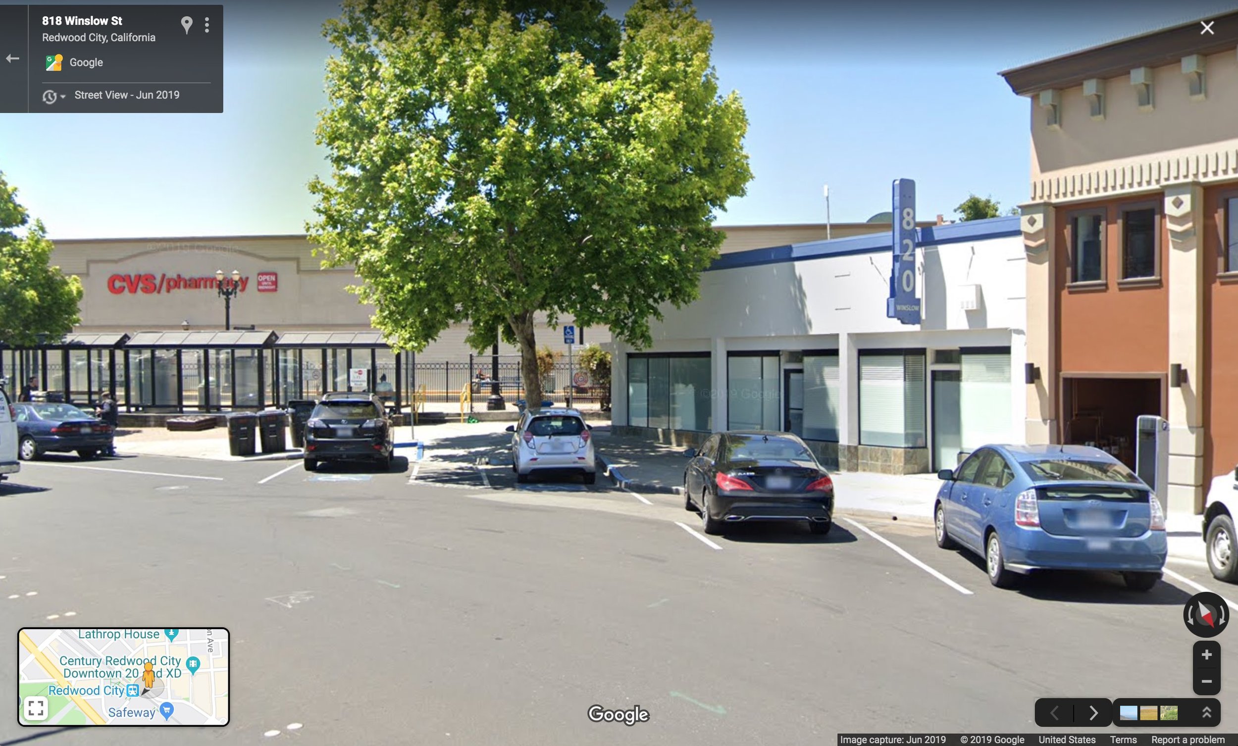
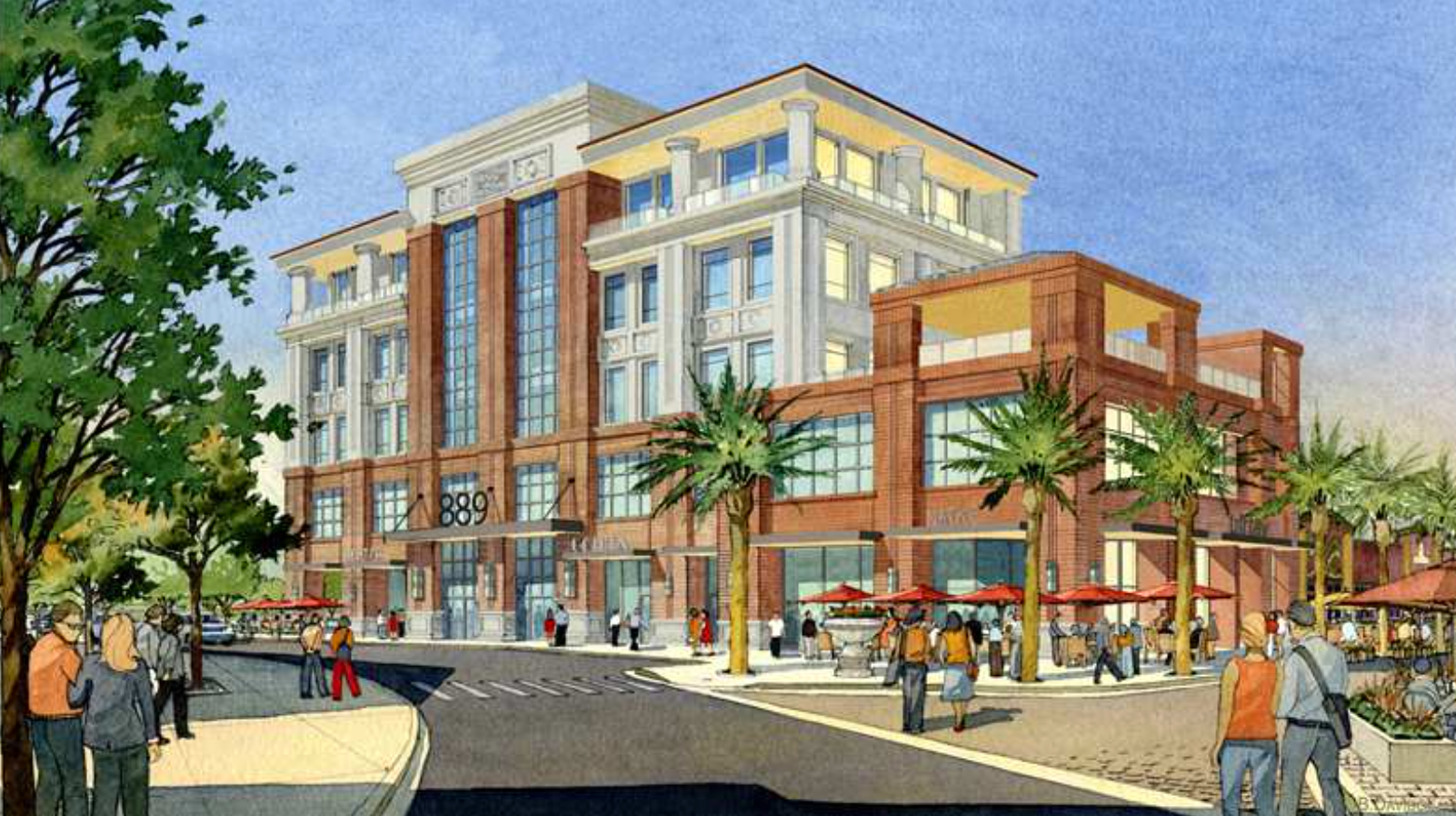
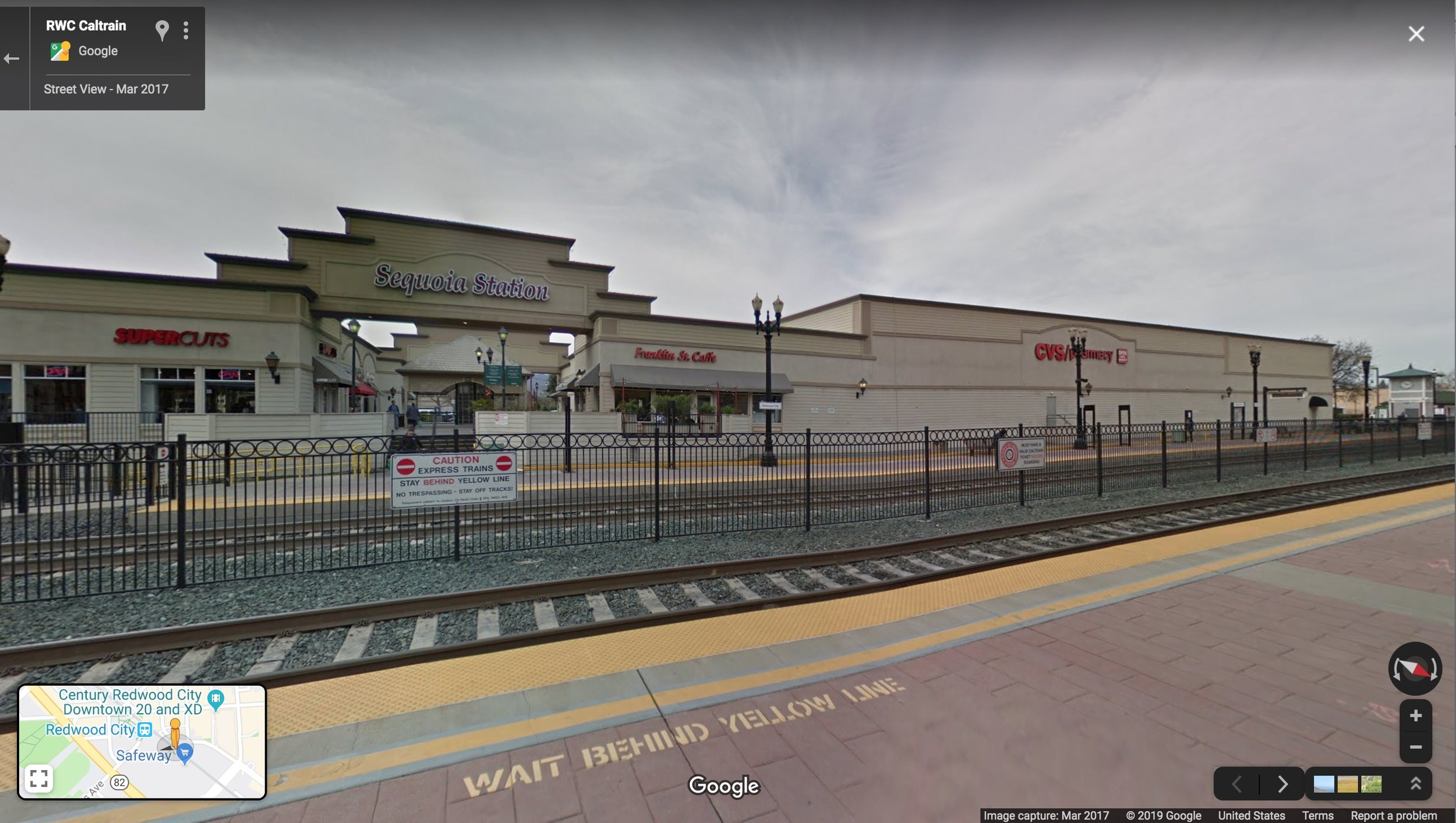
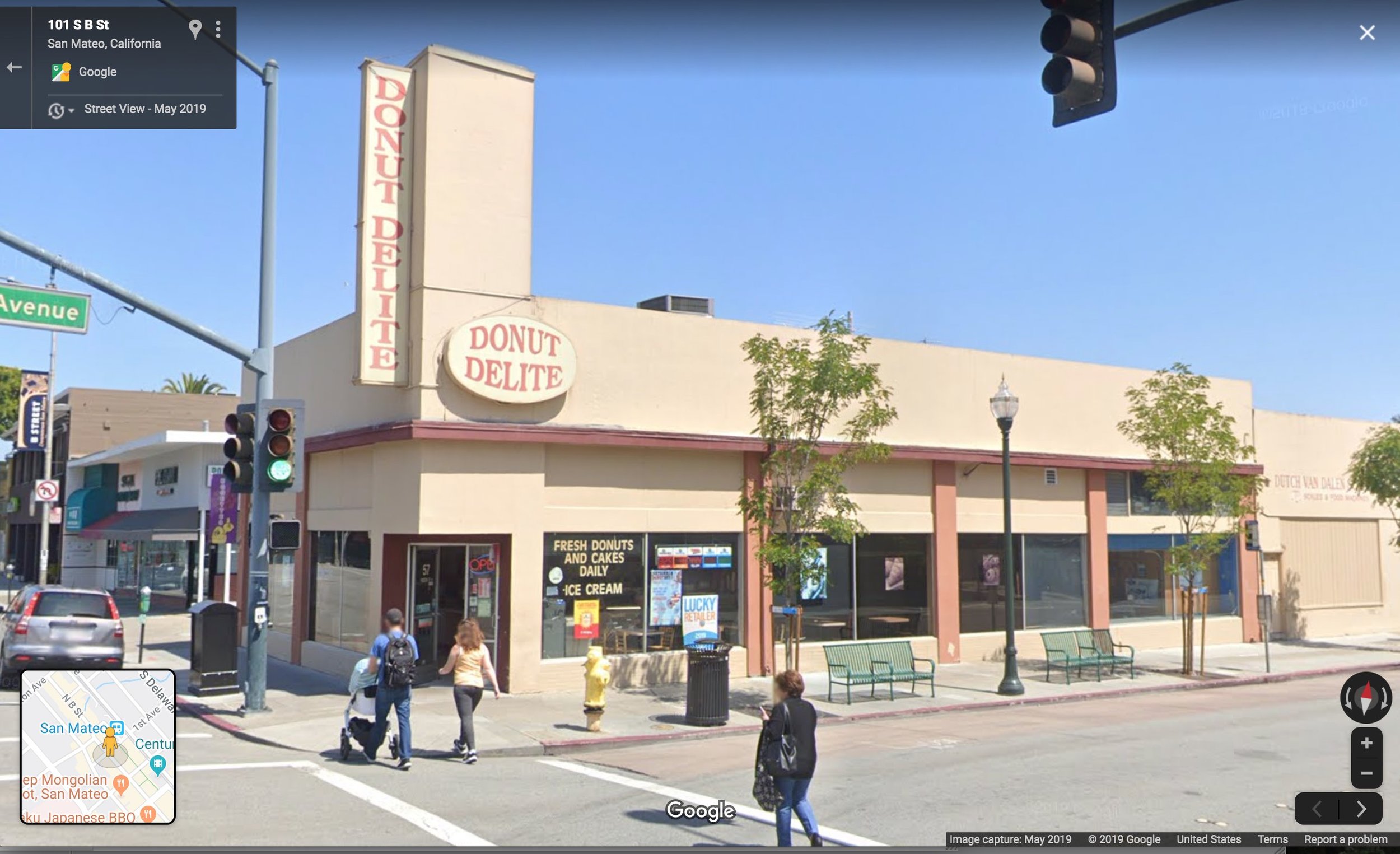
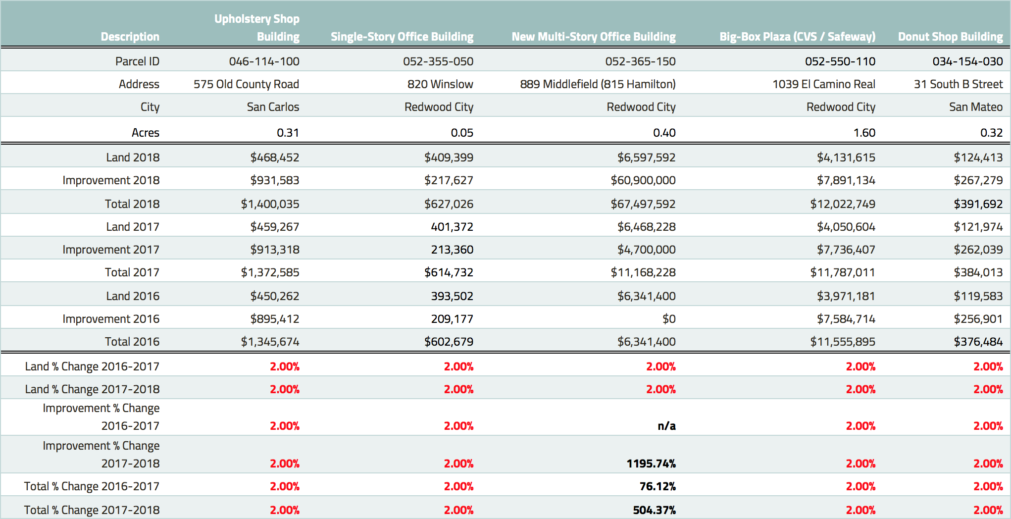
The last slide shows the year-over-year increase in taxable value of precisely 2.00 percent, applied to both the land and buildings in all five locations (except in the case of the new-construction office building). That's Prop 13 at work. And it means you can hold on to your land for a long time until you're ready to sell (for a massive windfall).
These building owners aren't doing anything wrong as individuals. They're probably making rational decisions in the system that's been established for them. But that system, in aggregate, results in a huge economic distortion.
The Effect of Decades of Distortion: Go-Big-or-Go-Home Development Economics
This is the toughest nut to crack. If we look at what is being built near Caltrain stations, we see things that represent a dramatic leap in development intensity, from one-story strip mall to huge building, like that Redwood City example, which went from a $6 million piece of land to a $6 million piece of land with a $60 million building on it.
“Repairing a damaged ecosystem is not an easy task, and it’s not a brute-force task. How great would it be if all we had to do to replace our lost old-growth forests was go plant some trees?”
That kind of development is something only a handful of companies can pull off. They need massive resources, the projects are logistically and legally complicated, often involve a lot of public consultation and a lengthy permitting process, and as a result, we only see a few of them happening at any one time. There are probably a lot of owners who wouldn't mind cashing out, selling their land to the next 815 Winslow developer... but most won't. It's like playing the lottery.
And zoning for smaller projects at lower densities doesn’t make things easier, because the land itself is so valuable from decades of suppressed demand that smaller projects don’t make any economic sense. They’re especially unlikely if an alternative prospect on the table, from the land owner’s perspective, is to wait for zoning changes. The owner of that upholstery shop in San Carlos can turn it into housing if they want to: per the current zoning code, they could build up to 6 apartments or condos on the site, in a building up to 30 feet tall. Those 6 condos might fetch $6-12 million in the Bay Area’s overheated market. But Redwood City is a couple miles away, and Redwood City passed a downtown plan that allowed for a $60 million office building on a lot of similar size. If I’m sitting on that upholstery shop in San Carlos, and I think the city might pass a Redwood City-style TOD plan in the next few years, why on earth would I sell now?
Repairing the Ecosystem
If you’re looking for the part where I tell you exactly what will fix all of this, you’re going to be disappointed. I don’t believe there is a short-term fix for the effects of 70+ years of messing up our land-use pattern with rules intended to suppress neighborhoods’ evolution, to place them in suspended animation. Repairing a damaged ecosystem, likewise, is not an easy task, and it’s not a brute-force task. How great would it be if all we had to do to replace our lost old-growth forests was go plant some trees?
What we can do is practice via negativa: systematically remove distortions and give the system room to breathe. In the case of the Bay Area, one thing that would help is allowing every neighborhood to evolve to the next increment of development. This means not just these locations right at train stations (many of which are zoned for much bigger buildings than currently exist, as we’ve seen), but the low-rise neighborhoods spilling up into the hills and down toward the bay. Let those areas thicken up with duplexes, triplexes, accessory apartments, small apartment buildings, corner stores. Take some of the pressure off the handful of TOD areas currently absorbing sky-high demand, and the not-yet-TOD areas whose land values are inflated anyway in anticipation of a future windfall.
That organic, evolutionary process, driven by millions of pieces of micro-feedback (individual transactions or land-use decisions) is the only thing that, in the long run, will lead to a healthy economic ecosystem.
(Cover photo by dataandpolitics via Twitter)


Daniel Herriges has been a regular contributor to Strong Towns since 2015 and is a founding member of the Strong Towns movement. He is the co-author of Escaping the Housing Trap: The Strong Towns Response to the Housing Crisis, with Charles Marohn. Daniel now works as the Policy Director at the Parking Reform Network, an organization which seeks to accelerate the reform of harmful parking policies by educating the public about these policies and serving as a connecting hub for advocates and policy makers. Daniel’s work reflects a lifelong fascination with cities and how they work. When he’s not perusing maps (for work or pleasure), he can be found exploring out-of-the-way neighborhoods on foot or bicycle. Daniel has lived in Northern California and Southwest Florida, and he now resides back in his hometown of St. Paul, Minnesota, along with his wife and two children. Daniel has a Masters in Urban and Regional Planning from the University of Minnesota.